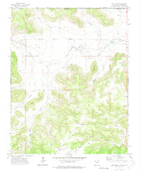
1972 Map of Tub Spring
USGS Topo · Published 1975About this map
The Dry Cimarron River winds across the high plains of the Colorado and New Mexico border, defining a landscape of deep drainages and isolated water sources. This 1972 field-checked survey of Union County captures the remote ranching character of the region, where survival is tied to specifically named points like Tub Spring and several remote pumping stations. The terrain is deeply incised by a network of steep-walled features, including Flathead Canyon, Miller Canyon, and Anderson Canyon, which channel seasonal runoff toward the primary riverbed. Human presence is sparse and focused on resource extraction and livestock management, evidenced by Gravel Pits and isolated developments such as the North Young Pocket Well and South Young Pocket Well. A single Jeep Trail provides passage through the broken country near Sloan Canyon, illustrating the era's limited infrastructure in this borderland territory.
Find a feature on this map
23 named features on this map. Tap any name to fly to it.
Don’t see what you’re looking for? This feature index may not catch every label — zoom into the map to look around manually.
Map Details
Editions of this 1972 Tub Spring Map
This is the sole edition of this map. No revisions or reprints were ever made.
Other maps of this area

1892 · Mt Carrizo
USGS Topo · 1:125,000

1954 · Dalhart
USGS Topo · 1:250,000

1955 · La Junta
USGS Topo · 1:250,000

1958 · La Junta
USGS Topo · 1:250,000

1958 · Dalhart
USGS Topo · 1:250,000

1962 · Dalhart
USGS Topo · 1:250,000

1968 · La Junta
USGS Topo · 1:250,000
1972 · Wedding Cake Butte
USGS Topo · 1:24,000

1972 · Travesser Park
USGS Topo · 1:24,000
1972 · Guy
USGS Topo · 1:24,000