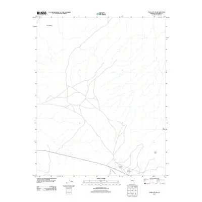
2011 Map of Tuba City SE
USGS Topo · Published 2011About this map
The landscape southeast of Tuba City is defined by deep drainages and striking geological landmarks in this 2011 survey. Notable terrain features like Blue Point, Round Rock, and the uniquely named The Ghost punctuate the high desert, showing the natural erosion patterns of the region. The map captures local community and recreational infrastructure, specifically the Coalmine Canyon Campground and the Coal Mine Rodeo Grounds located in the southern portion of the quadrangle. These sites reflect the intersection of traditional land use and modern tourism. Connectivity through this part of the Navajo Nation is facilitated by a network of local roads including Indian Rte 6710 and Indian Rte 6032, which cross a terrain largely shaped by seasonal watercourses.
Find a feature on this map
7 named features on this map. Tap any name to fly to it.
Don’t see what you’re looking for? This feature index may not catch every label — zoom into the map to look around manually.
Map Details
Editions of this 2011 Tuba City SE Map
This is the sole edition of this map. No revisions or reprints were ever made.
Other maps of this area

1883 · Marsh Pass
USGS Topo · 1:250,000

1883 · Tusayan
USGS Topo · 1:250,000

1886 · Tusayan
USGS Topo · 1:250,000

1886 · San Francisco Mtns
USGS Topo · 1:250,000

1886 · Echo Cliffs
USGS Topo · 1:250,000

1891 · San Francisco Mtns
USGS Topo · 1:250,000

1891 · Echo Cliffs
USGS Topo · 1:250,000

1892 · Marsh Pass
USGS Topo · 1:250,000

1894 · San Francisco Mtns
USGS Topo · 1:250,000

1899 · San Francisco Mtns
USGS Topo · 1:250,000