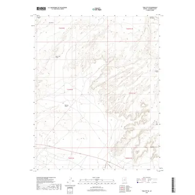
2018 Map of Tuba City SE
USGS Topo · Published 2018About this map
Moenkopi Wash defines the northern reaches of this high desert terrain, flowing past Round Rock toward the dramatic incisions of the Colorado Plateau. The landscape is characterized by a complex network of erosional features, most notably the deep recesses of Water Thief Canyon and Ha Ho No Geh Canyon. This area southeast of Tuba City is primarily defined by its landforms rather than dense settlement, showing the transition from the Moenkopi Plateau into the striking formations of Coal Mine Canyon. Local transit is facilitated by routes such as Indian Rte 6710, which skirt the edges of distinctive landmarks like The Ghost and Blue Point. The map provides a detailed view of the township and range system across this part of Coconino County, preserving the nomenclature of the Navajo Nation's intricate geography.
Find a feature on this map
16 named features on this map. Tap any name to fly to it.
Don’t see what you’re looking for? This feature index may not catch every label — zoom into the map to look around manually.
Map Details
Editions of this 2018 Tuba City SE Map
This is the sole edition of this map. No revisions or reprints were ever made.
Other maps of this area

1883 · Marsh Pass
USGS Topo · 1:250,000

1883 · Tusayan
USGS Topo · 1:250,000

1886 · Tusayan
USGS Topo · 1:250,000

1886 · San Francisco Mtns
USGS Topo · 1:250,000

1886 · Echo Cliffs
USGS Topo · 1:250,000

1891 · San Francisco Mtns
USGS Topo · 1:250,000

1891 · Echo Cliffs
USGS Topo · 1:250,000

1892 · Marsh Pass
USGS Topo · 1:250,000

1894 · San Francisco Mtns
USGS Topo · 1:250,000

1899 · San Francisco Mtns
USGS Topo · 1:250,000