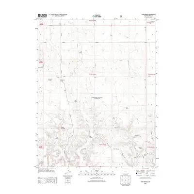
2013 Map of Tubs Springs
USGS Topo · Published 2013About this map
Comanche National Grassland preserves a landscape defined by its vital water sources and historic cattle routes at the dawn of the 21st century. The terrain is deeply incised by drainages such as East Sand Canyon, Middle Sand Canyon, and Dripping Vat Canyon, which provided shelter and seasonal water for early ranchers and travelers. This 2013 survey is particularly significant for its mapping of named historic paths, including the Outlaw Trail 1885, Homestead Trail 1883, and Arch Rock Trail 1881, which trace the movements of pioneers and fugitives across this arid frontier. Essential water points like Tubs Springs, Ramon Spring, and Dipping Vat Spring are clearly marked, alongside landmarks of local interest such as the Wisdom Tooth formation and Picture Canyon. The presence of the Mamnie Windmill and East Sand Canyon Windmill indicates the ongoing reliance on groundwater in this sparsely populated region.
Find a feature on this map
42 named features on this map. Tap any name to fly to it.
Don’t see what you’re looking for? This feature index may not catch every label — zoom into the map to look around manually.
Map Details
Editions of this 2013 Tubs Springs Map
This is the sole edition of this map. No revisions or reprints were ever made.
Other maps of this area

1891 · Springfield
USGS Topo · 1:125,000

1893 · Springfield
USGS Topo · 1:125,000

1954 · Dalhart
USGS Topo · 1:250,000

1955 · La Junta
USGS Topo · 1:250,000

1958 · La Junta
USGS Topo · 1:250,000

1958 · Dalhart
USGS Topo · 1:250,000

1962 · Dalhart
USGS Topo · 1:250,000

1968 · La Junta
USGS Topo · 1:250,000

1968 · Autograph Cliff NW
USGS Topo · 1:24,000

1968 · Kenton
USGS Topo · 1:24,000