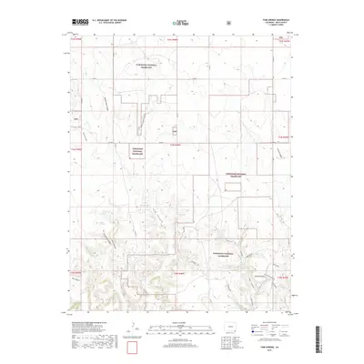
2019 Map of Tubs Springs
USGS Topo · Published 2019About this map
Tubs Springs and Ramon Spring offer rare water sources within the high-plains landscape of the Comanche National Grassland. This 2019 survey documents a terrain defined by deep erosional features like Middle Sand Canyon, East Sand Canyon, and the named formations of Wisdom Tooth and Arch Rock. The map illustrates a sparse but deliberate network of local roads such as Co RD 13 and Co RD G, which navigate around canyon systems like Dipping Vat Canyon and Pat Canyon. Traces of ranching and early land use are evident in labels such as Dipping Vat Spring and Homestead, indicating the historical reliance on these specific geographical features for survival and livestock management in a dry environment. The presence of Picture Canyon in the eastern section suggests a landscape with significant geological and potentially cultural interest.
Find a feature on this map
38 named features on this map. Tap any name to fly to it.
Don’t see what you’re looking for? This feature index may not catch every label — zoom into the map to look around manually.
Map Details
Editions of this 2019 Tubs Springs Map
This is the sole edition of this map. No revisions or reprints were ever made.
Other maps of this area

1891 · Springfield
USGS Topo · 1:125,000

1893 · Springfield
USGS Topo · 1:125,000

1954 · Dalhart
USGS Topo · 1:250,000

1955 · La Junta
USGS Topo · 1:250,000

1958 · La Junta
USGS Topo · 1:250,000

1958 · Dalhart
USGS Topo · 1:250,000

1962 · Dalhart
USGS Topo · 1:250,000

1968 · La Junta
USGS Topo · 1:250,000

1968 · Autograph Cliff NW
USGS Topo · 1:24,000

1968 · Kenton
USGS Topo · 1:24,000