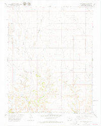
1979 Map of Tubs Springs
USGS Topo · Published 1979About this map
Tubs Springs serves as a focal point in this 1970s landscape where the high plains of Baca County, Colorado, meet Cimarron County, Oklahoma. This arid borderland is defined by a network of seasonal watercourses and drainage systems, including West Sand Canyon, Middle Sand Canyon, and the deep incisions of Picture Canyon. The presence of numerous watering spots such as Cross L Spring, Ramon Spring, and Cave Spring underscores the critical importance of water rights and livestock management in this ranching country. Human impact is marked by scattered infrastructure like the Little Dandy Windmill and Mammie Windmill, alongside evidence of early resource extraction at a small Quarry and Gravel Pit. Small markers like a lonely Grave and a simple Cem provide a quiet connection to the families who worked this land along Cañon Gallinas.
Find a feature on this map
23 named features on this map. Tap any name to fly to it.
Don’t see what you’re looking for? This feature index may not catch every label — zoom into the map to look around manually.
Map Details
Editions of this 1979 Tubs Springs Map
This is the sole edition of this map. No revisions or reprints were ever made.
Other maps of this area

1891 · Springfield
USGS Topo · 1:125,000

1893 · Springfield
USGS Topo · 1:125,000

1954 · Dalhart
USGS Topo · 1:250,000

1955 · La Junta
USGS Topo · 1:250,000

1958 · La Junta
USGS Topo · 1:250,000

1958 · Dalhart
USGS Topo · 1:250,000

1962 · Dalhart
USGS Topo · 1:250,000

1968 · La Junta
USGS Topo · 1:250,000

1968 · Autograph Cliff NW
USGS Topo · 1:24,000

1968 · Kenton
USGS Topo · 1:24,000