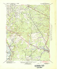
1941 Map of Tuckahoe
USGS Topo · Published 1941About this map
Port Elizabeth and the Maurice River basin form the industrial heart of this 1941 tactical survey, prepared by the Corps of Engineers, U.S. Army. The landscape is defined by its extraction and transit networks, with numerous sand and gravel operations such as the N J Washed Sand & Stone Co and National Sand & Gravel Co dotting the terrain. The rail infrastructure is particularly dense, showing the routes of the Pennsylvania Reading Seashore Lines and the Atlantic City RR, connecting rural outposts like Dorothy Station and Mauricetown Station.
Find a feature on this map
105 named features on this map. Tap any name to fly to it.
Don’t see what you’re looking for? This feature index may not catch every label — zoom into the map to look around manually.
Map Details
Editions of this 1941 Tuckahoe Map
This is the sole edition of this map. No revisions or reprints were ever made.
Other maps of this area

1884 · Sea Isle
USGS Topo · 1:62,500

1888 · Dennisville
USGS Topo · 1:62,500

1888 · Sea Isle
USGS Topo · 1:62,500

1890 · Great Egg Harbor
USGS Topo · 1:62,500

1890 · Hammonton
USGS Topo · 1:62,500

1890 · Tuckahoe
USGS Topo · 1:62,500

1890 · Maurice Cove
USGS Topo · 1:62,500

1890 · Bridgeton
USGS Topo · 1:62,500

1890 · Mullica
USGS Topo · 1:62,500

1890 · Glassboro
USGS Topo · 1:62,500