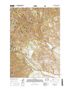
2017 Map of Tucker Flat
USGS Topo · Published 2017About this map
The Whitman National Forest dominates the northern reaches of this Union County terrain, where ridges like Mann Ridge and Summit Spring Ridge overlook a complex system of water management. The landscape transition from high forest to the North Powder Valley is marked by an extensive network of irrigation infrastructure, including the Shaw Brant Ditch, Lone Pine Ditch, and Coughanour Ditch. These channels represent the essential water-diversion history of the region, feeding from various creek systems to support the valley below. Significant water storage is provided by the Wolf Creek Reservoir and Pilcher Creek Reservoir, which sit at the base of the foothills. Historical land use is further indicated by local landmarks such as Tucker Flat and the dramatic Anthony Gorge, while numerous springs like Goff Spring and Bowman Spring signify the vital natural water sources that once dictated early travel and grazing routes.
Find a feature on this map
52 named features on this map. Tap any name to fly to it.
Don’t see what you’re looking for? This feature index may not catch every label — zoom into the map to look around manually.
Map Details
Editions of this 2017 Tucker Flat Map
This is the sole edition of this map. No revisions or reprints were ever made.
Other maps of this area

1901 · Baker City
USGS Topo · 1:125,000

1901 · Sumpter
USGS Topo · 1:125,000

1906 · Telocaset
USGS Topo · 1:125,000

1953 · Pendleton
USGS Topo · 1:250,000

1955 · Baker
USGS Topo · 1:250,000

1955 · Grangeville
USGS Topo · 1:250,000

1955 · Canyon City
USGS Topo · 1:250,000

1956 · Pendleton
USGS Topo · 1:250,000

1959 · Baker
USGS Topo · 1:250,000

1959 · Grangeville
USGS Topo · 1:250,000