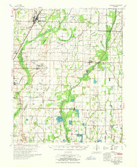
1967 Map of Tuckerman
USGS Topo · Published 1967About this map
The Cache River and Village Creek dominate this landscape in the mid-1960s, winding through the boundary regions of Jackson County, Craighead County, and Poinsett County. This survey reveals a highly managed hydrological environment, defined by an intricate network of drainage features like Tupelo Slough, Skillet Ditch, and Pompeys Ditch alongside the numerous fish hatcheries near Amagon. These systems support a rural economy that once relied on industry like Stringers Mill and local hubs such as Balch and Algoa.
Find a feature on this map
89 named features on this map. Tap any name to fly to it.
Don’t see what you’re looking for? This feature index may not catch every label — zoom into the map to look around manually.
Map Details
Editions of this 1967 Tuckerman Map
This is the sole edition of this map. No revisions or reprints were ever made.
Other maps of this area

1932 · Strawberry
USGS Topo · 1:62,500

1935 · Sedgwick
USGS Topo · 1:62,500

1935 · Alicia
USGS Topo · 1:62,500

1935 · Strawberry
USGS Topo · 1:62,500

1935 · Newport
USGS Topo · 1:62,500

1935 · Augusta
USGS Topo · 1:62,500

1935 · Tuckerman
USGS Topo · 1:62,500

1939 · Vanndale
USGS Topo · 1:62,500

1939 · Weiner
USGS Topo · 1:62,500

1940 · Tilton
USGS Topo · 1:62,500