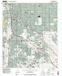
1996 Map of Tucson
USGS Topo · Published 2002About this map
Tucson expands across the high desert floor in the late 1990s, anchored by the sprawling University of Arizona campus and the industrial corridors of the Southern Pacific railroad. The map captures a complex urban landscape where traditional neighborhoods like the Old Pascua-Yaqui Indian Village and the independent enclave of South Tucson meet modern commercial hubs like El Con Mall. To the east, the massive footprint of the Davis-Monthan Air Force Base dominates the terrain, while the city's southern reaches are defined by the Tucson International Airport and the settlement at Emery Park. The ephemeral Santa Cruz River and several drainage washes, including Julian Wash and Rodeo Wash, provide a topographical framework for the city's grid, illustrating the hydrological management essential to this desert metropolitan area.
Find a feature on this map
36 named features on this map. Tap any name to fly to it.
Don’t see what you’re looking for? This feature index may not catch every label — zoom into the map to look around manually.
Map Details
Editions of this 1996 Tucson Map
This is the sole edition of this map. No revisions or reprints were ever made.
Other maps of this area

1904 · Tucson
USGS Topo · 1:125,000

1905 · Tucson
USGS Topo · 1:125,000

1925 · San Xavier
USGS Topo · 1:62,500

1934 · Tucson Mountains
USGS Topo · 1:125,000

1943 · San Xavier Mission
USGS Topo · 1:62,500

1947 · Cortaro
USGS Topo · 1:62,500

1948 · Tucson
USGS Topo · 1:62,500

1956 · Tucson
USGS Topo · 1:250,000

1957 · Tucson East
USGS Topo · 1:24,000

1957 · San Xavier Mission
USGS Topo · 1:62,500