
1957 Map of Tucson East
USGS Topo · Published 1958About this map
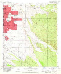
Davis-Monthan Air Force Base dominates the southern landscape of this mid-century survey, illustrating the significant military footprint on the outskirts of Tucson. The eastern expansion of the city is evident through a dense network of educational and religious institutions, including St Josephs Academy, the Reina Cleri Seminary, and numerous specialized campuses like the Abbie Loveland Tuller School and Arizona Sunshine School. This concentration of schools suggests a rapidly growing suburban frontier transitioning from the arid reaches of the Pantano Wash to organized residential developments like Vandenberg Village. Along the southern edge, the Southern Pacific Railroad passes through Littletown, while the USC&GS Magnetic Observatory sits in a still-undeveloped corridor, marking a time when scientific and military interests anchored the desert's edge before the full arrival of modern sprawl.
Find a feature on this map
40 named features on this map. Tap any name to fly to it.
Don’t see what you’re looking for? This feature index may not catch every label — zoom into the map to look around manually.
Map Details
Editions of this 1957 Tucson East Map
4 editions found
Other maps of this area

1904 · Tucson
USGS Topo · 1:125,000

1905 · Tucson
USGS Topo · 1:125,000

1948 · Tucson
USGS Topo · 1:62,500

1956 · Tucson
USGS Topo · 1:250,000

1957 · Bellota Ranch
USGS Topo · 1:62,500

1957 · Tucson
USGS Topo · 1:24,000

1957 · Tucson
USGS Topo · 1:62,500

1957 · Rincon Valley
USGS Topo · 1:62,500

1957 · Sabino Canyon
USGS Topo · 1:24,000
1957 · Tucson North
USGS Topo · 1:24,000