
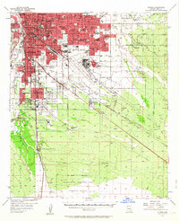
1957 Map of Tucson
USGS Topo · Published 1958About this map
The Santa Cruz River and Pantano Wash define the desert landscape of this mid-century Arizona hub, where urban growth was rapidly expanding into the cactus-studded valley. The city of Tucson and its neighbor South Tucson are shown during a period of significant post-war modernization, evident in the dense network of new schools like Catalina H S and Rincon High Sch appearing alongside older landmarks like the Veterans Hospital.
Find a feature on this map
90 named features on this map. Tap any name to fly to it.
Don’t see what you’re looking for? This feature index may not catch every label — zoom into the map to look around manually.
Map Details
Editions of this 1957 Tucson Map
2 editions found
Other maps of this area

1904 · Patagonia
USGS Topo · 1:125,000

1904 · Tucson
USGS Topo · 1:125,000

1905 · Patagonia
USGS Topo · 1:125,000

1905 · Tucson
USGS Topo · 1:125,000

1920 · Arivaca
USGS Topo · 1:125,000

1925 · Samaniego Peak
USGS Topo · 1:62,500

1925 · San Xavier
USGS Topo · 1:62,500

1926 · Helvetia
USGS Topo · 1:62,500

1934 · Tucson Mountains
USGS Topo · 1:125,000

1939 · Twin Buttes
USGS Topo · 1:62,500