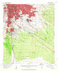
1957 Map of Tucson
USGS Topo · Published 1963About this map
The University of Arizona and the expanding urban core of Tucson anchor this mid-century survey, revealing a landscape transitioning from desert ranching to a major military and educational hub. The growth of South Tucson and neighborhoods like Pueblo Gardens and Vandenberg Village contrasts with the established boundaries of the San Xavier Indian Reservation to the southwest. To the south and east, the massive footprint of the Davis Monthan Air Force Base and the Sahuarita Bombing and Gunnery Range dominates the terrain, while the Southern Pacific Railroad and the Old Sonora Road trace historic transportation corridors. Local life is documented through numerous schools and institutions, such as St Josephs Academy and the Reina Cleri Seminary, alongside scattered outposts like the MacMurtrie Ranch and Patty Ranch in the southern desert reaches.
Find a feature on this map
86 named features on this map. Tap any name to fly to it.
Don’t see what you’re looking for? This feature index may not catch every label — zoom into the map to look around manually.
Map Details
Editions of this 1957 Tucson Map
2 editions found

Other maps of this area

1904 · Patagonia
USGS Topo · 1:125,000

1904 · Tucson
USGS Topo · 1:125,000

1905 · Patagonia
USGS Topo · 1:125,000

1905 · Tucson
USGS Topo · 1:125,000

1920 · Arivaca
USGS Topo · 1:125,000

1925 · Samaniego Peak
USGS Topo · 1:62,500

1925 · San Xavier
USGS Topo · 1:62,500

1926 · Helvetia
USGS Topo · 1:62,500

1934 · Tucson Mountains
USGS Topo · 1:125,000

1939 · Twin Buttes
USGS Topo · 1:62,500