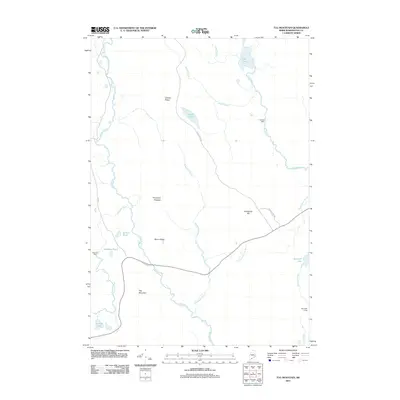
2011 Map of Tug Mountain
USGS Topo · Published 2011About this map
Machias River and Old Stream dominate this interior landscape of Washington County, where the topography is defined by prominent elevations like Tug Mountain and Bacon Ridge. This 2011 survey captures the network of water bodies and timber-access routes that characterize this part of Maine, including the remote Worcester Lodge and several water-management points like Robinson Dam and Canaan Dam. The terrain is a complex system of drainage and ridges, with named features such as Porcupine Pinnacle and Breakneck Hill rising above the surrounding lowlands.
Find a feature on this map
25 named features on this map. Tap any name to fly to it.
Don’t see what you’re looking for? This feature index may not catch every label — zoom into the map to look around manually.
Map Details
Editions of this 2011 Tug Mountain Map
This is the sole edition of this map. No revisions or reprints were ever made.
Other maps of this area

1941 · Wesley
USGS Topo · 1:62,500

1941 · Tug Mountain
USGS Topo · 1:62,500

1941 · Big Lake
USGS Topo · 1:62,500

1941 · Wabassus Lake
USGS Topo · 1:62,500

1943 · Big Lake
USGS Topo · 1:62,500

1943 · Tug Mountain
USGS Topo · 1:62,500

1943 · Wesley
USGS Topo · 1:62,500

1943 · Wabassus Lake
USGS Topo · 1:62,500

1952 · Big Lake
USGS Topo · 1:50,000

1953 · Wabassus Lake
USGS Topo · 1:62,500