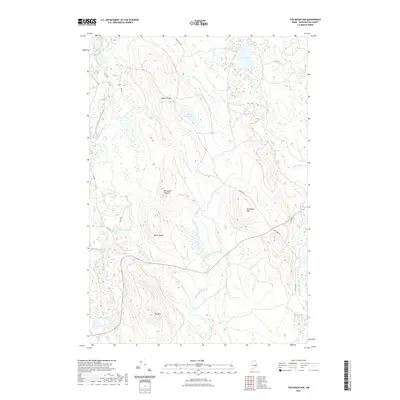
2021 Map of Tug Mountain
USGS Topo · Published 2021About this map
Tug Mtn rises above a complex network of waterways and timber-management corridors in this section of Washington County. The Machias River and its western branch dominate the western edge of the map, while Old Stream and Pembroke Stream drain the eastern elevations. The landscape is defined by its numerous glacial water bodies, including First Lake, Bowles Lake, and the smaller Salmon Pond. Significant ridges like Canaan Ridge and Bacon Ridge separate these drainage basins, providing local elevation against the low-lying wetlands. Historically, the area is crisscrossed by utility and logging routes such as the CCC RD and Old Rte 9, reflecting a long history of forest resource management. Landmarks like Porcupine Pinnacle and Breakneck Hill offer distinct navigational points within the dense topography of this coastal interior region.
Find a feature on this map
28 named features on this map. Tap any name to fly to it.
Don’t see what you’re looking for? This feature index may not catch every label — zoom into the map to look around manually.
Map Details
Editions of this 2021 Tug Mountain Map
This is the sole edition of this map. No revisions or reprints were ever made.
Other maps of this area

1941 · Wesley
USGS Topo · 1:62,500

1941 · Tug Mountain
USGS Topo · 1:62,500

1941 · Big Lake
USGS Topo · 1:62,500

1941 · Wabassus Lake
USGS Topo · 1:62,500

1943 · Big Lake
USGS Topo · 1:62,500

1943 · Tug Mountain
USGS Topo · 1:62,500

1943 · Wesley
USGS Topo · 1:62,500

1943 · Wabassus Lake
USGS Topo · 1:62,500

1952 · Big Lake
USGS Topo · 1:50,000

1953 · Wabassus Lake
USGS Topo · 1:62,500