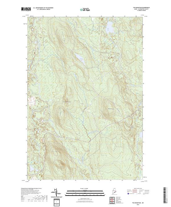
2024 Map of Tug Mountain
USGS Topo · Published 2024About this map
The Machias River and its West Branch Machias River dominate this interior landscape of Washington County, winding through a complex network of wetlands and upland ridges. The terrain is defined by prominent elevations like Tug Mtn and Breakneck Hill, which overlook a series of remote water bodies including Bowles Lake and the descriptive Kerosene Pond. Historically, this area has been shaped by the timber and transport needs of eastern Maine, evidenced by the presence of numerous forestry and access routes such as the CCC RD and Sugar Camp Rd.
Find a feature on this map
28 named features on this map. Tap any name to fly to it.
Don’t see what you’re looking for? This feature index may not catch every label — zoom into the map to look around manually.
Map Details
Editions of this 2024 Tug Mountain Map
This is the sole edition of this map. No revisions or reprints were ever made.
Other maps of this area

1941 · Wesley
USGS Topo · 1:62,500

1941 · Tug Mountain
USGS Topo · 1:62,500

1941 · Big Lake
USGS Topo · 1:62,500

1941 · Wabassus Lake
USGS Topo · 1:62,500

1943 · Big Lake
USGS Topo · 1:62,500

1943 · Tug Mountain
USGS Topo · 1:62,500

1943 · Wesley
USGS Topo · 1:62,500

1943 · Wabassus Lake
USGS Topo · 1:62,500

1952 · Big Lake
USGS Topo · 1:50,000

1953 · Wabassus Lake
USGS Topo · 1:62,500