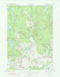
1941 Map of Tug Mountain
USGS Topo · Published 1965About this map
The Machias River and Mopang Stream define a wild, water-dominated landscape across this portion of Washington County, surveyed shortly before the United States entered the Second World War. The area is characterized by an extensive network of ponds and ridges, largely organized into unorganized townships like T 30 M D and T 24 M D. Settlement is sparse, appearing primarily as sporting or logging camps tucked into the hills, including Hartford Camp and Allison Worcester Camp.
Find a feature on this map
107 named features on this map. Tap any name to fly to it.
Don’t see what you’re looking for? This feature index may not catch every label — zoom into the map to look around manually.
Map Details
Editions of this 1941 Tug Mountain Map
2 editions found

Other maps of this area

1902 · Cherryfield
USGS Topo · 1:62,500

1904 · Cherryfield
USGS Topo · 1:62,500

1921 · Columbia Falls
USGS Topo · 1:62,500

1921 · Columbia Falls
USGS Topo · 1:62,500

1929 · Lead Mountain
USGS Topo · 1:48,000

1930 · Tunk Lake
USGS Topo · 1:48,000

1932 · Tunk Lake
USGS Topo · 1:62,500

1932 · Nicatous Lake
USGS Topo · 1:48,000

1932 · Lead Mountain
USGS Topo · 1:62,500

1934 · Nicatous Lake
USGS Topo · 1:62,500