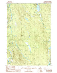
1990 Map of Tug Mountain
USGS Topo · Published 1990About this map
Machias River and its tributaries carve through this unorganized territory of Washington County, a landscape defined more by its water and timber potential than by permanent settlement. The presence of Canaan Dam and a Gravel Pit suggests the industrial and infrastructural footprint of mid-century forestry operations in this interior Maine region. Topographical landmarks like Canaan Ridge, Bacon Ridge, and the prominent Tug Mountain rise above a dense network of water bodies, including Bowles Lake and the unusually named Kerosene Pond.
Find a feature on this map
30 named features on this map. Tap any name to fly to it.
Don’t see what you’re looking for? This feature index may not catch every label — zoom into the map to look around manually.
Map Details
Editions of this 1990 Tug Mountain Map
This is the sole edition of this map. No revisions or reprints were ever made.
Other maps of this area

1941 · Wesley
USGS Topo · 1:62,500

1941 · Tug Mountain
USGS Topo · 1:62,500

1941 · Big Lake
USGS Topo · 1:62,500

1941 · Wabassus Lake
USGS Topo · 1:62,500

1943 · Big Lake
USGS Topo · 1:62,500

1943 · Tug Mountain
USGS Topo · 1:62,500

1943 · Wesley
USGS Topo · 1:62,500

1943 · Wabassus Lake
USGS Topo · 1:62,500

1952 · Big Lake
USGS Topo · 1:50,000

1953 · Wabassus Lake
USGS Topo · 1:62,500