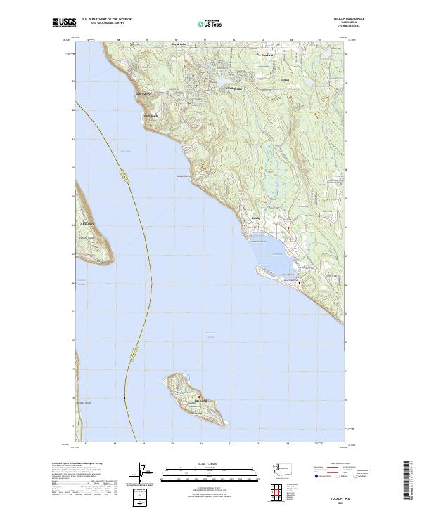
2023 Map of Tulalip
USGS Topo · Published 2023About this map
Tulalip serves as the central hub of this coastal Snohomish County landscape, where the waters of Possession Sound and Tulalip Bay meet the shoreline. The map documents a blend of residential growth and natural resource management, notably featuring the Tulalip Salmon Rearing Pond and several small inland lakes including Lake Goodwin and Weallup Lake. Local history is anchored by the Mission Beach Cem near Skiou Point, while the surrounding geography includes the prominent Hat Island, also labeled as Gedney Island.
Find a feature on this map
105 named features on this map. Tap any name to fly to it.
Don’t see what you’re looking for? This feature index may not catch every label — zoom into the map to look around manually.
Map Details
Editions of this 2023 Tulalip Map
This is the sole edition of this map. No revisions or reprints were ever made.
Other maps of this area

1895 · Snohomish
USGS Topo · 1:125,000

1897 · Seattle
USGS Topo · 1:125,000

1911 · Mount Vernon
USGS Topo · 1:125,000

1941 · Marysville
USGS Topo · 1:62,500

1942 · Edmonds
USGS Topo · 1:62,500

1943 · Marysville
USGS Topo · 1:62,500

1943 · Stanwood
USGS Topo · 1:62,500

1944 · Everett
USGS Topo · 1:62,500
1953 · Maxwelton
USGS Topo · 1:24,000
1953 · Mukilteo
USGS Topo · 1:24,000