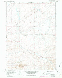
1958 Map of Tule Butte
USGS Topo · Published 1980About this map
The Emigrant Trail cuts across the northwestern corner of this high-desert landscape, marking the historic path through Sweetwater County. Published in 1980 with primary data from 1958, this map documents a ranching and transport corridor centered on the Middle Hay Ranch and its associated Airstrip. The drainage system is dominated by the confluence of Dry Sandy Creek and Pacific Creek, which flow through the northern reaches, while the southern terrain rises into the Jack Morrow Hills.
Find a feature on this map
12 named features on this map. Tap any name to fly to it.
Don’t see what you’re looking for? This feature index may not catch every label — zoom into the map to look around manually.
Map Details
Editions of this 1958 Tule Butte Map
2 editions found
Other maps of this area

1955 · Lander
USGS Topo · 1:250,000

1958 · Lander
USGS Topo · 1:250,000

1958 · Parting of the Ways
USGS Topo · 1:62,500

1958 · Essex Mountain
USGS Topo · 1:62,500

1958 · Hay Meadow Reservoir
USGS Topo · 1:24,000

1958 · Tule Butte
USGS Topo · 1:24,000

1958 · Parting of the Ways
USGS Topo · 1:24,000

1961 · Lander
USGS Topo · 1:250,000

1968 · Eden Reservoir East
USGS Topo · 1:24,000
1968 · Fifteenmile Spring
USGS Topo · 1:24,000