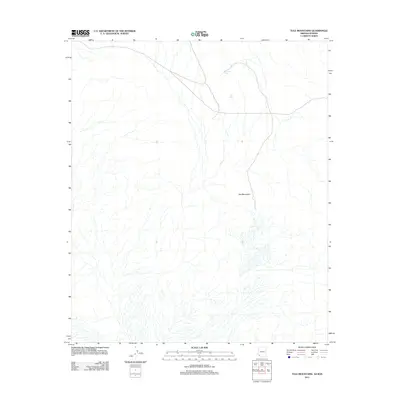
2011 Map of Tule Mountains
USGS Topo · Published 2011About this map
Tule Mountains dominate this arid landscape along the Arizona-Sonora border region, characterized by a complex network of dry washes and ephemeral drainage patterns. This 2011 survey illustrates the sparse but critical water infrastructure necessary for life in the high desert, specifically identifying Buckhorn Tank and Tule Tank as primary catchments in an otherwise desiccated terrain. The map's detail focuses on the physical geography of the desert floor and the rising slopes of the mountain range, providing a precise record of the land surface before contemporary shifts in climate or border activity might alter these natural features. For researchers or historians focused on the Sonoran desert, the placement of these tanks relative to the mountain topography offers insight into traditional water management and travel through this frontier zone.
Find a feature on this map
3 named features on this map. Tap any name to fly to it.
Don’t see what you’re looking for? This feature index may not catch every label — zoom into the map to look around manually.
Map Details
Editions of this 2011 Tule Mountains Map
This is the sole edition of this map. No revisions or reprints were ever made.
Other maps of this area

1953 · Ajo
USGS Topo · 1:250,000

1957 · Ajo
USGS Topo · 1:250,000

1958 · Ajo
USGS Topo · 1:250,000

1962 · Ajo
USGS Topo · 1:250,000

1963 · Ajo
USGS Topo · 1:250,000

1965 · Cabeza Prieta Peak
USGS Topo · 1:62,500
1965 · Tule Mountains
USGS Topo · 1:62,500

1965 · Isla Pinta
USGS Topo · 1:62,500

1965 · Sierra Arida
USGS Topo · 1:62,500

1967 · Ajo
USGS Topo · 1:250,000