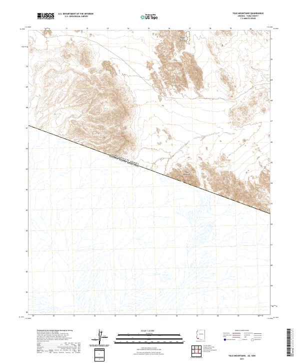
2021 Map of Tule Mountains
USGS Topo · Published 2021About this map
The international border between the United States of America and Estados Unidos Mexicanos cuts diagonally across this desert landscape, marking the southern edge of the Yuma County wilderness. The topography is dominated by the jagged elevations of the Cabeza Prieta Mountains and the Tule Mountains, which rise sharply from the arid floor. In an environment defined by extreme aridity, essential water sources are clearly identified, including Buckhorn Tank and Tule Tank. These features represent critical survival points for travelers and local fauna in the borderlands. The map provides a precise layout of the Public Land Survey System grid, including townships t13s r15w and t14s r15w, illustrating how geopolitical boundaries were imposed over this ancient, stark terrain.
Find a feature on this map
11 named features on this map. Tap any name to fly to it.
Don’t see what you’re looking for? This feature index may not catch every label — zoom into the map to look around manually.
Map Details
Editions of this 2021 Tule Mountains Map
This is the sole edition of this map. No revisions or reprints were ever made.
Other maps of this area

1953 · Ajo
USGS Topo · 1:250,000

1957 · Ajo
USGS Topo · 1:250,000

1958 · Ajo
USGS Topo · 1:250,000

1962 · Ajo
USGS Topo · 1:250,000

1963 · Ajo
USGS Topo · 1:250,000

1965 · Cabeza Prieta Peak
USGS Topo · 1:62,500
1965 · Tule Mountains
USGS Topo · 1:62,500

1965 · Isla Pinta
USGS Topo · 1:62,500

1965 · Sierra Arida
USGS Topo · 1:62,500

1967 · Ajo
USGS Topo · 1:250,000