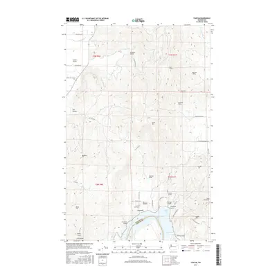
2017 Map of Tumtum
USGS Topo · Published 2017About this map
Long Lake and its northern shores anchor this 2017 survey where the Stevens County and Spokane County lines meet. The small settlement of Tumtum serves as the local hub, situated just north of the water near where Scotts Valley opens into the larger basin. The landscape is defined by its varied terrain, from the broad expanse of Walkers Prairie in the northwest to the distinct peaks of Five Sisters and Scoop Mtn. Local history is preserved at the Scotts Valley Cem and Old Scotts Valley Cem, while family-named roads like Johnny Walker Way and Shannon Way mark the area's rural development. Recreational landmarks around the lake, including Sunset Bay and Willow Bay, are mapped alongside geological features such as Fortymile Canyon and Big Foot Valley.
Find a feature on this map
57 named features on this map. Tap any name to fly to it.
Don’t see what you’re looking for? This feature index may not catch every label — zoom into the map to look around manually.
Map Details
Editions of this 2017 Tumtum Map
This is the sole edition of this map. No revisions or reprints were ever made.
Other maps of this area

1927 · Chewelah
USGS Topo · 1:125,000

1930 · Chewelah
USGS Topo · 1:125,000

1944 · Clayton
USGS Topo · 1:62,500

1944 · Wellpinit
USGS Topo · 1:62,500

1950 · Clayton
USGS Topo · 1:62,500

1953 · Wellpinit
USGS Topo · 1:62,500

1955 · Spokane
USGS Topo · 1:250,000

1958 · Spokane
USGS Topo · 1:250,000

1958 · Sandpoint
USGS Topo · 1:250,000

1963 · Sandpoint
USGS Topo · 1:250,000