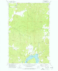
1973 Map of Tumtum
USGS Topo · Published 1977About this map
Tumtum sits along the northern banks of the Spokane River Long Lake at the boundary between Stevens and Spokane counties. This 1970s landscape is defined by the transition from the flat agricultural expanse of Walkers Prairie into the complex drainages of Fortymile Canyon and Rail Canyon. To the north, the Spokane Indian Reservation line follows the course of Chamokane Creek, while the southern shore of the lake features recreation and residential markers like Sunset Bay and a Trailer Park. Significant elevation changes are marked by prominent peaks such as Negro Mountain and Scoop Mountain. Local history researchers will find clear markers for the Tumtum Cem and family-named routes like Mc Allister Rd and Casberg Rd serving the valley homesteads.
Find a feature on this map
50 named features on this map. Tap any name to fly to it.
Don’t see what you’re looking for? This feature index may not catch every label — zoom into the map to look around manually.
Map Details
Editions of this 1973 Tumtum Map
This is the sole edition of this map. No revisions or reprints were ever made.
Other maps of this area

1927 · Chewelah
USGS Topo · 1:125,000

1930 · Chewelah
USGS Topo · 1:125,000

1944 · Clayton
USGS Topo · 1:62,500

1944 · Wellpinit
USGS Topo · 1:62,500

1950 · Clayton
USGS Topo · 1:62,500

1953 · Wellpinit
USGS Topo · 1:62,500

1955 · Spokane
USGS Topo · 1:250,000

1958 · Spokane
USGS Topo · 1:250,000

1958 · Sandpoint
USGS Topo · 1:250,000

1963 · Sandpoint
USGS Topo · 1:250,000