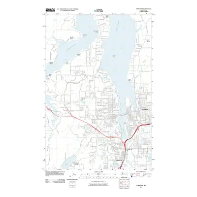
2011 Map of Tumwater
USGS Topo · Published 2011About this map
The state Capitol and the surrounding urban grid of Olympia anchor this 2011 survey, where the Deschutes River meets the southern reaches of Puget Sound. The map documents a complex landscape of water and infrastructure, featuring the Deschutes Dam and Percivals Landing at the head of Budd Inlet. In Tumwater, the Tumwater Falls Dam marks the river's descent toward Capitol Lake, illustrating the historical industrial core of the city.
Find a feature on this map
58 named features on this map. Tap any name to fly to it.
Don’t see what you’re looking for? This feature index may not catch every label — zoom into the map to look around manually.
Map Details
Editions of this 2011 Tumwater Map
This is the sole edition of this map. No revisions or reprints were ever made.
Other maps of this area

1916 · Chehalis
USGS Topo · 1:125,000

1937 · Olympia
USGS Topo · 1:62,500

1939 · Shelton
USGS Topo · 1:62,500

1940 · Tenino
USGS Topo · 1:62,500

1941 · Gate
USGS Topo · 1:62,500

1944 · Tenino
USGS Topo · 1:62,500

1949 · Tenino
USGS Topo · 1:62,500

1949 · Olympia
USGS Topo · 1:62,500

1953 · Hoquiam
USGS Topo · 1:250,000

1953 · Rochester
USGS Topo · 1:62,500