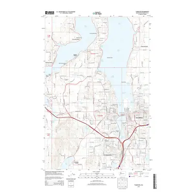
2014 Map of Tumwater
USGS Topo · Published 2014About this map
Olympia and Tumwater anchor this coastal survey, where the urban grid meets the intricate shorelines of Puget Sound. The state Capitol grounds overlook Capitol Lake and West Bay, marking the transition from the Deschutes River to the saltwater inlets. To the west, the campus of The Evergreen State Coll is situated near Snyder Cove and Eld Inlet, while the South Puget Sound Community Coll sits further south near Simmons Lake. The mapping reveals a distinct pattern of waterfront development along the peninsulas, with named communities such as Countryside Beach, Gravelly Beach, and Sunset Beach lining the various coves. Inland, the rail corridor of the BNSF Railway cuts through the landscape near Bush Prairie and Lamberts Corner, illustrating the transportation network connecting these South Sound hubs to the broader region.
Find a feature on this map
140 named features on this map. Tap any name to fly to it.
Don’t see what you’re looking for? This feature index may not catch every label — zoom into the map to look around manually.
Map Details
Editions of this 2014 Tumwater Map
This is the sole edition of this map. No revisions or reprints were ever made.
Other maps of this area

1916 · Chehalis
USGS Topo · 1:125,000

1937 · Olympia
USGS Topo · 1:62,500

1939 · Shelton
USGS Topo · 1:62,500

1940 · Tenino
USGS Topo · 1:62,500

1941 · Gate
USGS Topo · 1:62,500

1944 · Tenino
USGS Topo · 1:62,500

1949 · Tenino
USGS Topo · 1:62,500

1949 · Olympia
USGS Topo · 1:62,500

1953 · Hoquiam
USGS Topo · 1:250,000

1953 · Rochester
USGS Topo · 1:62,500