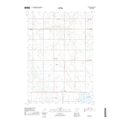
2017 Map of Tunerville
USGS Topo · Published 2017About this map
The Coteau des Prairies plateau defines the landscape of this region, where high prairie terrain is dotted with numerous glacial depressions and wetlands. In the southern portion of the map, the small settlement of Tunerville sits at the intersection of S Dakota Highway 15 and 172nd St, serving as a local waypoint just north of the expansive Lake Alice. The drainage patterns here are complex, with the S Fork Yellow Bank River winding across the northern sections while Caine Cr and Conner Slough manage the water on the lower slopes.
Find a feature on this map
26 named features on this map. Tap any name to fly to it.
Don’t see what you’re looking for? This feature index may not catch every label — zoom into the map to look around manually.
Map Details
Editions of this 2017 Tunerville Map
This is the sole edition of this map. No revisions or reprints were ever made.
Other maps of this area

1953 · Milbank
USGS Topo · 1:250,000

1953 · Watertown
USGS Topo · 1:250,000

1958 · Milbank
USGS Topo · 1:250,000

1958 · Watertown
USGS Topo · 1:250,000

1970 · Bemis
USGS Topo · 1:24,000

1970 · Goodwin
USGS Topo · 1:24,000

1973 · LaBolt
USGS Topo · 1:24,000

1973 · Tunerville
USGS Topo · 1:24,000

1973 · Stockholm
USGS Topo · 1:24,000
1973 · Revillo
USGS Topo · 1:24,000