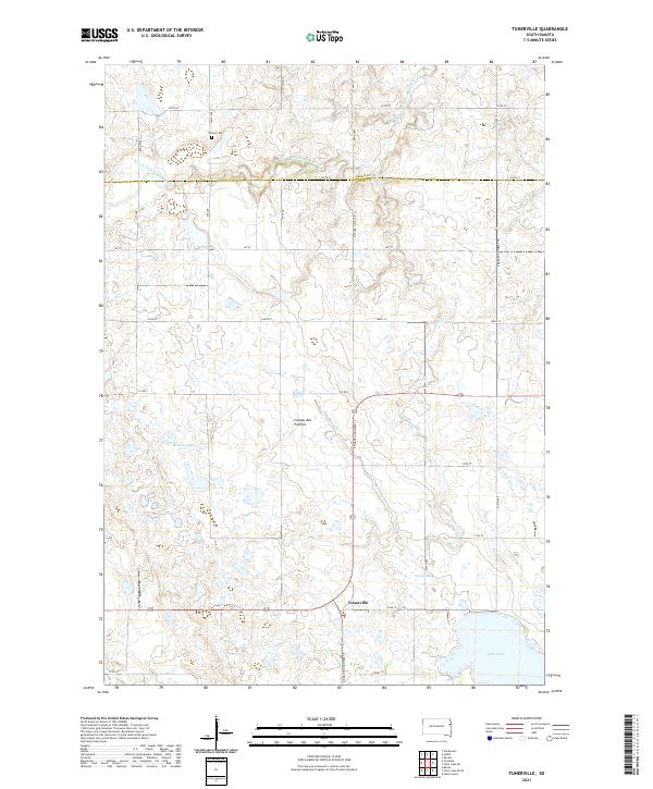
2021 Map of Tunerville
USGS Topo · Published 2021About this map
Tunerville sits at the southern edge of this upland landscape, part of the broader Coteau des Prairies plateau. The map details a water-rich prairie environment dominated by numerous glacial depressions, ranging from the sizeable Lake Alice and Midway Lake to more ephemeral features like Conner Slough. The S Fork Yellow Bank River and Caine Cr drain the eastern slopes of the coteau, carving subtle valleys through the township.
Find a feature on this map
34 named features on this map. Tap any name to fly to it.
Don’t see what you’re looking for? This feature index may not catch every label — zoom into the map to look around manually.
Map Details
Editions of this 2021 Tunerville Map
This is the sole edition of this map. No revisions or reprints were ever made.
Other maps of this area

1953 · Milbank
USGS Topo · 1:250,000

1953 · Watertown
USGS Topo · 1:250,000

1958 · Milbank
USGS Topo · 1:250,000

1958 · Watertown
USGS Topo · 1:250,000

1970 · Bemis
USGS Topo · 1:24,000

1970 · Goodwin
USGS Topo · 1:24,000

1973 · LaBolt
USGS Topo · 1:24,000

1973 · Tunerville
USGS Topo · 1:24,000

1973 · Stockholm
USGS Topo · 1:24,000
1973 · Revillo
USGS Topo · 1:24,000