
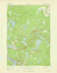
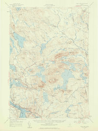
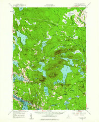
1957 Map of Tunk Lake
USGS Topo · Published 1972About this map
Taunton Bay and Hog Bay define the coastal character of this mid-century survey, where the rugged topography of Schoodic Mtn and Caribou Mtn meets the saltwater inlets of the Maine coast. The landscape is a complex network of glacial ponds and heaths, including Denbo Heath and Rock Dam Heath, interspersed with family-named ridges like Martin Ridge. The maritime economy and local infrastructure are visible through features like the Tidal Flat near Franklin and the presence of a Fish Hatchery and Quarry.
Find a feature on this map
156 named features on this map. Tap any name to fly to it.
Don’t see what you’re looking for? This feature index may not catch every label — zoom into the map to look around manually.
Map Details
Editions of this 1957 Tunk Lake Map
4 editions found
Other maps of this area

1902 · Cherryfield
USGS Topo · 1:62,500

1904 · Cherryfield
USGS Topo · 1:62,500

1904 · Mount Desert
USGS Topo · 1:62,500

1904 · Bar Harbor
USGS Topo · 1:62,500

1904 · Petit Manan
USGS Topo · 1:62,500

1911 · Ellsworth
USGS Topo · 1:62,500

1929 · Great Pond
USGS Topo · 1:48,000

1929 · Lead Mountain
USGS Topo · 1:48,000

1930 · Tunk Lake
USGS Topo · 1:48,000

1932 · Tunk Lake
USGS Topo · 1:62,500