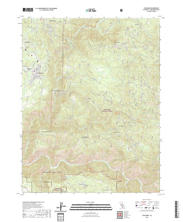
2021 Map of Tuolumne
USGS Topo · Published 2021About this map
Tuolumne City and the neighboring town of Tuolumne anchor the western edge of this landscape, where the Sierra Nevada foothills meet the managed lands of the Stanislaus National Forest. The transition from town to wilderness is marked by the legacy of local industry, particularly along the West Side R/R Grade Trl and roads such as Old Buchanan Mine Rd that hint at the region's mining and timber history. North of the main settlements, the communities of Cherokee and Arastraville are preserved near the Cherokee Arastraville Cem, while the rugged southern terrain is dominated by the Tuolumne Wild and Scenic River. Small outliers like the settlement of Buchanan and landmarks such as Hermitage Airport provide a detailed look at the rural habitation patterns within t1n r16e and surrounding townships during the early 21st century.
Find a feature on this map
138 named features on this map. Tap any name to fly to it.
Don’t see what you’re looking for? This feature index may not catch every label — zoom into the map to look around manually.
Map Details
Editions of this 2021 Tuolumne Map
This is the sole edition of this map. No revisions or reprints were ever made.
Other maps of this area

1891 · Big Trees
USGS Topo · 1:125,000

1893 · Sonora
USGS Topo · 1:125,000

1894 · Big Trees
USGS Topo · 1:125,000

1896 · Sonora
USGS Topo · 1:125,000

1897 · Sonora
USGS Topo · 1:125,000

1897 · Big Trees
USGS Topo · 1:125,000

1898 · Sonora
USGS Topo · 1:125,000

1901 · Big Trees
USGS Topo · 1:125,000

1947 · Sacramento
USGS Topo · 1:250,000

1947 · San Jose
USGS Topo · 1:250,000