
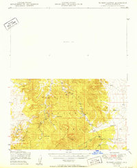
1950 Map of Turkey Canyon
USGS Topo · Published 1950About this map
The Juniper Mountains dominate this high-country landscape within the Prescott National Forest, where a network of remote outposts and water sources supported the ranching economy of the mid-20th century. Named landmarks such as Happy Camp and Lower Corrals indicate the pastoral utility of the terrain, while the extensive Luis Maria Baca Float No 5 boundary reflects the complex history of Spanish land grants in Yavapai County. The northern portion of the sheet is largely designated as an Unsurveyed Area, contrasting with the more detailed topography to the south. Water management is a primary theme of the settlement pattern, shown through several Dams, Windmills, and storage points like Hutch Tank and Section 10 Tank. Drainage from the heights is captured by Turkey Canyon and Pine Creek, which provide the essential geographic framework for this isolated mountain region.
Find a feature on this map
18 named features on this map. Tap any name to fly to it.
Don’t see what you’re looking for? This feature index may not catch every label — zoom into the map to look around manually.
Map Details
Editions of this 1950 Turkey Canyon Map
2 editions found
Other maps of this area

1886 · Diamond Creek
USGS Topo · 1:250,000

1886 · Chino
USGS Topo · 1:250,000

1887 · Prescott
USGS Topo · 1:250,000

1891 · Chino
USGS Topo · 1:250,000

1892 · Diamond Creek
USGS Topo · 1:250,000

1892 · Prescott
USGS Topo · 1:250,000

1923 · Signal
USGS Topo · 1:250,000

1942 · Signal
USGS Topo · 1:250,000

1947 · Simmons
USGS Topo · 1:62,500

1947 · Picacho Butte
USGS Topo · 1:62,500