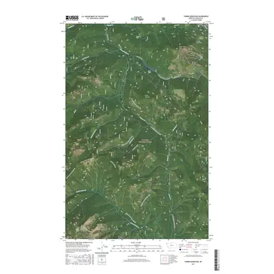
2017 Map of Turner Mountain
USGS Topo · Published 2017About this map
Kootenai National Forest dominates this section of the Purcell Mountains, a landscape defined by prominent summits and an extensive network of seasonal trails. This 2017 survey details a high-elevation environment where recreation and forestry management intersect. Named peaks such as Turner Mtn, Loon Peak, and Huson Peak overlook a drainage system including Seventeenmile Cr and W Fork Quartz Cr. The infrastructure here is heavily oriented toward outdoor access, highlighted by the 17 Mile/Quartz Snowmobile route and the Skyline NRT (W Fork Quartz) trail system. Water bodies like Loon Lake and China Lake are situated in the high basins, while secondary routes like China Rim/Flagstaff and Quartz Mtn Snowmobile Spur provide access to the more remote ridges and forest boundaries.
Find a feature on this map
45 named features on this map. Tap any name to fly to it.
Don’t see what you’re looking for? This feature index may not catch every label — zoom into the map to look around manually.
Map Details
Editions of this 2017 Turner Mountain Map
This is the sole edition of this map. No revisions or reprints were ever made.
Other maps of this area

1920 · Libby
USGS Topo · 1:125,000

1930 · Libby
USGS Topo · 1:125,000

1932 · Libby
USGS Topo · 1:125,000

1957 · Kalispell
USGS Topo · 1:250,000

1960 · Kalispell
USGS Topo · 1:250,000

1961 · Kalispell
USGS Topo · 1:250,000

1963 · Scenery Mountain
USGS Topo · 1:24,000

1963 · Turner Mountain
USGS Topo · 1:24,000

1963 · Sylvanite
USGS Topo · 1:24,000

1963 · Pulpit Mountain
USGS Topo · 1:24,000