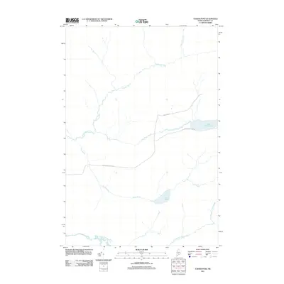
2011 Map of Turner Pond
USGS Topo · Published 2011About this map
The Baker Branch Saint John River winds through the southwestern corner of this Somerset County landscape, anchoring a drainage network of remote northern brooks. This early 21st-century topography highlights the industrial logging history of the Maine woods, defined by the presence of International Paper Rd and Baker Lake Rd cutting through the forest. These private ways facilitate access to the water systems that define the region, including the isolated basin of Turner Pond and the larger expanse of Saint Francis Lake. The map reveals the intricate hydrology of the territory, where Desolation Brook, Saint Francis Brook, and North Branch Campbell Brook create a dense web of waterways. This is a snapshot of working timberlands, where the landscape is organized primarily around resource management and the natural flow of the St. John River's tributaries.
Find a feature on this map
9 named features on this map. Tap any name to fly to it.
Don’t see what you’re looking for? This feature index may not catch every label — zoom into the map to look around manually.
Map Details
Editions of this 2011 Turner Pond Map
This is the sole edition of this map. No revisions or reprints were ever made.
Other maps of this area

1954 · Baker Lake
USGS Topo · 1:62,500

1954 · Caucomgomoc Lake
USGS Topo · 1:62,500

1954 · Allagash Lake
USGS Topo · 1:62,500

1954 · St. John Pond
USGS Topo · 1:62,500

1954 · Presque Isle
USGS Topo · 1:250,000

1958 · Presque Isle
USGS Topo · 1:250,000

1958 · Caucomgomoc Lake
USGS Topo · 1:62,500

1958 · Saint John Pond
USGS Topo · 1:62,500

1960 · Presque Isle
USGS Topo · 1:250,000

1961 · Allagash Lake
USGS Topo · 1:62,500