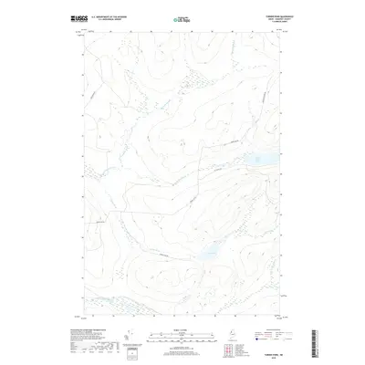
2018 Map of Turner Pond
USGS Topo · Published 2018About this map
Baker Branch Saint John River winds through the southern reaches of this Somerset County landscape, anchoring a complex drainage system in the North Maine Woods. The terrain is defined by its water-rich geography, where Saint Francis Lake and Turner Pond serve as focal points for the surrounding network of brooks. Logistical access into this timberland environment is traced via a series of established routes, including Baker Lake Rd and St Francis Rd, which cut through the high-elevation contours. Named features such as Desolation Brook and Turner Brook suggest the solitary character of this working forest, while the inclusion of N Br Campbell Brook provides a detailed view of the headwaters that feed the larger river basins of the region.
Find a feature on this map
12 named features on this map. Tap any name to fly to it.
Don’t see what you’re looking for? This feature index may not catch every label — zoom into the map to look around manually.
Map Details
Editions of this 2018 Turner Pond Map
This is the sole edition of this map. No revisions or reprints were ever made.
Other maps of this area

1954 · Baker Lake
USGS Topo · 1:62,500

1954 · Caucomgomoc Lake
USGS Topo · 1:62,500

1954 · Allagash Lake
USGS Topo · 1:62,500

1954 · St. John Pond
USGS Topo · 1:62,500

1954 · Presque Isle
USGS Topo · 1:250,000

1958 · Presque Isle
USGS Topo · 1:250,000

1958 · Caucomgomoc Lake
USGS Topo · 1:62,500

1958 · Saint John Pond
USGS Topo · 1:62,500

1960 · Presque Isle
USGS Topo · 1:250,000

1961 · Allagash Lake
USGS Topo · 1:62,500