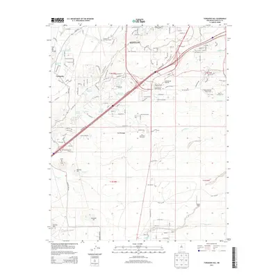
2013 Map of Turquoise Hill
USGS Topo · Published 2013About this map
The Santa Fe River and the high desert terrain southwest of the state capital define this landscape as it appeared in the early 21st century. The map centers on the traditional communities of Cieneguilla and La Cienega, where the convergence of several drainages, including Arroyo Hondo and Cienega Creek, created a historic oasis in the arid basin. To the south, the namesake Turquoise Hill and the northern edge of the Cerrillos Hills represent an area with long associations with mineral extraction. This region is a study in modern utility and traditional settlement, where the Santa Fe Municipal Airport and the New Mexico State Penitentiary share the map with older place names like Pueblo Cañon. Significant educational and cultural institutions are noted, including the Institute of American Indian and Alaska Native Culture and the Santa Fe Community College, illustrating the area's development as an extension of the capital's civic infrastructure.
Find a feature on this map
70 named features on this map. Tap any name to fly to it.
Don’t see what you’re looking for? This feature index may not catch every label — zoom into the map to look around manually.
Map Details
Editions of this 2013 Turquoise Hill Map
This is the sole edition of this map. No revisions or reprints were ever made.
Other maps of this area

1889 · Santa Fe
USGS Topo · 1:125,000

1892 · San Pedro
USGS Topo · 1:125,000

1892 · Santa Clara
USGS Topo · 1:125,000

1894 · Santa Fe
USGS Topo · 1:125,000

1894 · Lamy
USGS Topo · 1:125,000

1951 · Agua Fria
USGS Topo · 1:24,000

1951 · Turquoise Hill
USGS Topo · 1:24,000

1952 · Santa Fe
USGS Topo · 1:24,000

1952 · Turquoise Hill
USGS Topo · 1:24,000

1952 · Seton Village
USGS Topo · 1:24,000