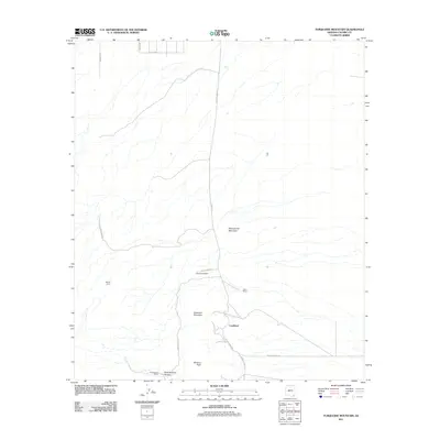
2011 Map of Turquoise Mountain
USGS Topo · Published 2011About this map
Turquoise Mountain and the surrounding high desert of Cochise County define this landscape, where the legacy of early 20th-century mining and ranching is still etched into the terrain. The settlement of Courtland serves as the focal point, situated at the intersection of various ranch roads and the evocative Ghost Town Trl. The map documents a sparse but persistent human presence, characterized by remote family operations such as Busenbark Ranch, Telles Ranch, and Christensen Ranch.
Find a feature on this map
21 named features on this map. Tap any name to fly to it.
Don’t see what you’re looking for? This feature index may not catch every label — zoom into the map to look around manually.
Map Details
Editions of this 2011 Turquoise Mountain Map
This is the sole edition of this map. No revisions or reprints were ever made.
Other maps of this area

1916 · Pearce
USGS Topo · 1:125,000

1922 · Swisshelm
USGS Topo · 1:62,500

1925 · Gleeson
USGS Topo · 1:62,500

1926 · Light
USGS Topo · 1:62,500

1926 · Courtland
USGS Topo · 1:62,500

1955 · Douglas
USGS Topo · 1:250,000
1957 · Hay Mountain
USGS Topo · 1:24,000

1958 · Squaretop Hills
USGS Topo · 1:62,500

1958 · Swisshelm Mtn
USGS Topo · 1:62,500

1958 · Pearce
USGS Topo · 1:62,500