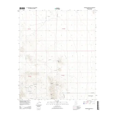
2014 Map of Turquoise Mountain
USGS Topo · Published 2014About this map
Turquoise Mountain and Browns Peak dominate the topography of this corner of Cochise County, anchoring a landscape shaped by a legacy of mining and ranching. Near the base of the peaks lies Courtland, a site once bustling with activity during the early twentieth-century copper boom. The modern road network reflects this history through evocative names like N Ghost Town Trl, W Copper Belle Rd, and W Keystone Rd, which trace the paths of former extraction sites and transit routes.
Find a feature on this map
27 named features on this map. Tap any name to fly to it.
Don’t see what you’re looking for? This feature index may not catch every label — zoom into the map to look around manually.
Map Details
Editions of this 2014 Turquoise Mountain Map
This is the sole edition of this map. No revisions or reprints were ever made.
Other maps of this area

1916 · Pearce
USGS Topo · 1:125,000

1922 · Swisshelm
USGS Topo · 1:62,500

1925 · Gleeson
USGS Topo · 1:62,500

1926 · Light
USGS Topo · 1:62,500

1926 · Courtland
USGS Topo · 1:62,500

1955 · Douglas
USGS Topo · 1:250,000
1957 · Hay Mountain
USGS Topo · 1:24,000

1958 · Squaretop Hills
USGS Topo · 1:62,500

1958 · Swisshelm Mtn
USGS Topo · 1:62,500

1958 · Pearce
USGS Topo · 1:62,500