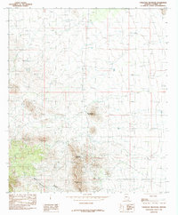
1985 Map of Turquoise Mountain
USGS Topo · Published 1985About this map
Turquoise Mountain and its surrounding peaks dominate this landscape in Cochise County, reflecting the area's geological and extractive history. The terrain is marked by numerous Mine and Prospect symbols, particularly near the mountain slopes, indicating a history of mineral exploration. A distinct Cem stands as a point of interest for genealogists tracking early residents of this high-desert environment.
Find a feature on this map
14 named features on this map. Tap any name to fly to it.
Don’t see what you’re looking for? This feature index may not catch every label — zoom into the map to look around manually.
Map Details
Editions of this 1985 Turquoise Mountain Map
This is the sole edition of this map. No revisions or reprints were ever made.
Other maps of this area

1916 · Pearce
USGS Topo · 1:125,000

1922 · Swisshelm
USGS Topo · 1:62,500

1925 · Gleeson
USGS Topo · 1:62,500

1926 · Light
USGS Topo · 1:62,500

1926 · Courtland
USGS Topo · 1:62,500

1955 · Douglas
USGS Topo · 1:250,000
1957 · Hay Mountain
USGS Topo · 1:24,000

1958 · Squaretop Hills
USGS Topo · 1:62,500

1958 · Swisshelm Mtn
USGS Topo · 1:62,500

1958 · Pearce
USGS Topo · 1:62,500