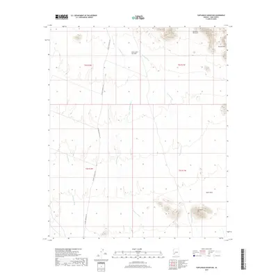
2018 Map of Turtleback Mountain
USGS Topo · Published 2018About this map
Turtleback Mtn and the southeastern spurs of the Gila Bend Mountains define the arid landscape of this Yuma County quadrangle. The terrain transitions from these prominent elevations into the broad expanse of the Hyder Valley, characterized by a complex network of ephemeral watercourses. Principal drainage routes like Deadman Wash, Nottbusch Wash, and Red Raven Wash slice through the desert floor, indicating the heavy flow of seasonal monsoonal rains. Modern infrastructure is limited to the north-south corridor of Palomas Harquahala Rd, which provides access through this remote stretch of the Sonoran Desert. Smaller geological features like the Picacho Hills and the Stone Cabin Gap Wash offer specific landmarks for those navigating or studying the physical geography of the region.
Find a feature on this map
13 named features on this map. Tap any name to fly to it.
Don’t see what you’re looking for? This feature index may not catch every label — zoom into the map to look around manually.
Map Details
Editions of this 2018 Turtleback Mountain Map
This is the sole edition of this map. No revisions or reprints were ever made.
Other maps of this area

1927 · Hyder
USGS Topo · 1:62,500

1930 · Hyder
USGS Topo · 1:62,500

1942 · Vicksburg
USGS Topo · 1:250,000

1954 · Phoenix
USGS Topo · 1:250,000

1957 · Phoenix
USGS Topo · 1:250,000

1958 · Phoenix
USGS Topo · 1:250,000

1960 · Phoenix
USGS Topo · 1:250,000

1962 · Little Horn Mts
USGS Topo · 1:62,500

1962 · Eagletail Mts
USGS Topo · 1:62,500
1964 · Hyder NE
USGS Topo · 1:24,000