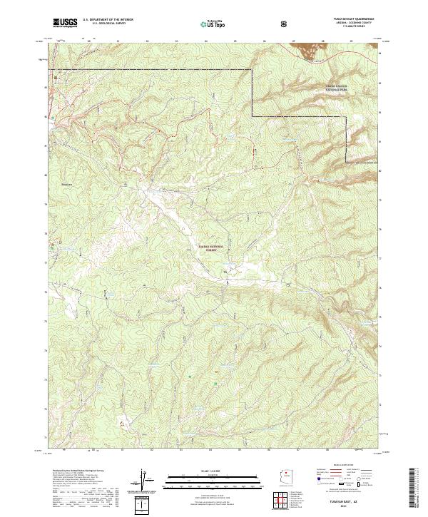
2021 Map of Tusayan East
USGS Topo · Published 2021About this map
Kaibab National Forest dominates this high-altitude landscape south of the South Rim, serving as a critical gateway to the canyon. The settlement of Tusayan stands as a focal point for infrastructure and tourism, surrounded by a complex network of recreational paths including the Arizona National Scenic Trl, the Tusayan Mtn Bike Loop Trl, and the Ten-X Nature Trl. The map illustrates a reliance on earthen water catchments across the plateau, with numerous named tanks such as Reed Tank, Indian Tank, and McRae Tank scattered through the forest. To the northeast, the terrain rises toward Skinner Ridge and the southern boundary of Grand Canyon National Park, where Desert View Drive begins its eastward traverse. This contemporary survey details the intersection of federal forest management, national park access, and localized water management in the arid Arizona uplands.
Find a feature on this map
40 named features on this map. Tap any name to fly to it.
Don’t see what you’re looking for? This feature index may not catch every label — zoom into the map to look around manually.
Map Details
Editions of this 2021 Tusayan East Map
This is the sole edition of this map. No revisions or reprints were ever made.
Other maps of this area

1886 · San Francisco Mtns
USGS Topo · 1:250,000

1886 · Chino
USGS Topo · 1:250,000

1886 · Echo Cliffs
USGS Topo · 1:250,000

1886 · Kaibab
USGS Topo · 1:250,000

1891 · San Francisco Mtns
USGS Topo · 1:250,000

1891 · Chino
USGS Topo · 1:250,000

1891 · Echo Cliffs
USGS Topo · 1:250,000

1894 · San Francisco Mtns
USGS Topo · 1:250,000

1899 · San Francisco Mtns
USGS Topo · 1:250,000

1903 · Bright Angel
USGS Topo · 1:48,000