
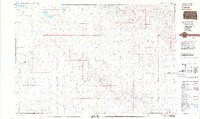
1981 Map of Tuthill
USGS Topo · Published 1981About this map
The Little White River meanders across this northern High Plains landscape in Bennett County, shaping the rural character of the region during the early 1980s. Small ranching settlements like Tuthill and Vetal serve as the primary hubs for this sparsely populated portion of South Dakota, where the economy is deeply tied to the surrounding grasslands and water sources. The map reveals the critical importance of isolated landmarks such as the England Sch and the community of Harrington at the eastern edge. Numerous water bodies, including White Lake, Silver Lake, and Twin Lakes, dot the northern terrain, while Pecks Creek feeds into the main river system. This survey illustrates a quiet era of Great Plains life, where surveyors recorded the essential roads and section lines that connected these remote prairie homesteads and school districts.
Find a feature on this map
10 named features on this map. Tap any name to fly to it.
Don’t see what you’re looking for? This feature index may not catch every label — zoom into the map to look around manually.
Map Details
Editions of this 1981 Tuthill Map
2 editions found
Other maps of this area

1955 · Martin
USGS Topo · 1:250,000

1958 · Martin
USGS Topo · 1:250,000

1969 · Eagle Mans Butte
USGS Topo · 1:24,000

1969 · Spring Creek SW
USGS Topo · 1:24,000

1969 · Iron Shell Flat West
USGS Topo · 1:24,000

1981 · Patricia
USGS Topo · 1:25,000

1981 · Phantom Lake
USGS Topo · 1:25,000

1981 · Martin
USGS Topo · 1:25,000

1981 · Blackpipe
USGS Topo · 1:25,000

1981 · Scotchman Lake
USGS Topo · 1:25,000