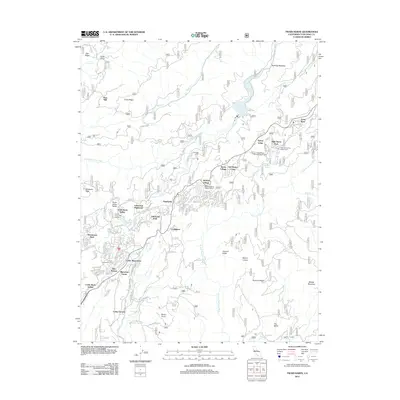
2012 Map of Twain Harte
USGS Topo · Published 2012About this map
Mi-Wuk Village and Sierra Village serve as central hubs in this Sierra Nevada landscape, where residential enclaves like Lakewood Highlands and Sherwood Forest are integrated into the timbered slopes. The area's resource-based history is evident in names like Hess Mill, Sugarpine, and the legacy of the Main Tuolumne Ditch. Significant infrastructure supports the region, including the Lyons Reservoir on the S Fork Stanislaus River and the Mi-Wok District Ranger Office.
Find a feature on this map
61 named features on this map. Tap any name to fly to it.
Don’t see what you’re looking for? This feature index may not catch every label — zoom into the map to look around manually.
Map Details
Editions of this 2012 Twain Harte Map
This is the sole edition of this map. No revisions or reprints were ever made.
Other maps of this area

1891 · Big Trees
USGS Topo · 1:125,000

1893 · Sonora
USGS Topo · 1:125,000

1894 · Big Trees
USGS Topo · 1:125,000

1896 · Sonora
USGS Topo · 1:125,000

1897 · Sonora
USGS Topo · 1:125,000

1897 · Big Trees
USGS Topo · 1:125,000

1898 · Sonora
USGS Topo · 1:125,000

1901 · Big Trees
USGS Topo · 1:125,000

1947 · Sacramento
USGS Topo · 1:250,000

1947 · San Jose
USGS Topo · 1:250,000