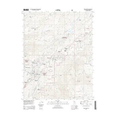
2015 Map of Twain Harte
USGS Topo · Published 2015About this map
Twain Harte and the surrounding foothill communities of the Stanislaus National Forest are shown during a period of established residential development and seasonal recreation. The map details a dense network of mountain settlements, including Mi-Wuk Village, Sierra Village, and the legacy of early industry at Hess Mill. Water management is a primary feature of the landscape, defined by the Lyons Reservoir and the Main Tuolumne Ditch, which snakes through the steep terrain to supply the region.
Find a feature on this map
74 named features on this map. Tap any name to fly to it.
Don’t see what you’re looking for? This feature index may not catch every label — zoom into the map to look around manually.
Map Details
Editions of this 2015 Twain Harte Map
This is the sole edition of this map. No revisions or reprints were ever made.
Other maps of this area

1891 · Big Trees
USGS Topo · 1:125,000

1893 · Sonora
USGS Topo · 1:125,000

1894 · Big Trees
USGS Topo · 1:125,000

1896 · Sonora
USGS Topo · 1:125,000

1897 · Sonora
USGS Topo · 1:125,000

1897 · Big Trees
USGS Topo · 1:125,000

1898 · Sonora
USGS Topo · 1:125,000

1901 · Big Trees
USGS Topo · 1:125,000

1947 · Sacramento
USGS Topo · 1:250,000

1947 · San Jose
USGS Topo · 1:250,000