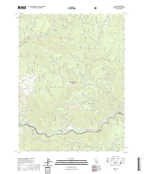
2021 Map of Twain
USGS Topo · Published 2021About this map
Seneca and Virgilia are two of several canyon-bottom settlements mapped along the forks of the N Fork Feather River and the East Branch North Fork Feather River. The map details a complex landscape of water-sculpted terrain within the Plumas National Forest, where deep ravines like Marion Ravine and Kingsbury Ravine descend from heights such as Cold Spring Hill and Eagle Rock. A history of gold mining and river-side activity is suggested by the presence of Meeker Bar, China Bar, and the Big Flat Cem near the river's bend. Infrastructure centers on the river corridor, where the Butterfly Valley-Twain Rd connects small hamlets like Twain, Grays Flat, and Hot Springs. The survey captures the intricate relationship between the mountainous topography and the persistent river-bank communities of the region.
Find a feature on this map
49 named features on this map. Tap any name to fly to it.
Don’t see what you’re looking for? This feature index may not catch every label — zoom into the map to look around manually.
Map Details
Editions of this 2021 Twain Map
This is the sole edition of this map. No revisions or reprints were ever made.
Other maps of this area

1886 · Honey Lake
USGS Topo · 1:250,000

1886 · Lassen Peak
USGS Topo · 1:250,000

1888 · Bidwell Bar
USGS Topo · 1:125,000

1891 · Bidwell Bar
USGS Topo · 1:125,000

1891 · Downieville
USGS Topo · 1:125,000

1891 · Honey Lake
USGS Topo · 1:250,000

1892 · Lassen Peak
USGS Topo · 1:250,000

1893 · Bidwell Bar
USGS Topo · 1:125,000

1893 · Honey Lake
USGS Topo · 1:250,000

1893 · Downieville
USGS Topo · 1:125,000