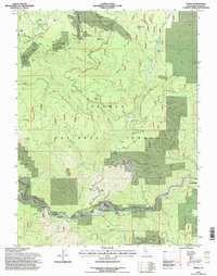
1994 Map of Twain
USGS Topo · Published 1997About this map
Placer and hard-rock mining legacies dominate this corridor of the North Fork Feather River within the Plumas National Forest. The map documents a landscape heavily shaped by mineral extraction, from the Dutch Hill Mine and its associated Dutch Hill Tunnel in the north to the Virgilia Mine further downstream. Settlements like Seneca and Twain are positioned along the steep river canyon, which also serves as the primary transportation artery for the Union Pacific railroad. The concentration of historical features like the Big Flat Cem and named river bars such as Meeker Bar and China Bar highlights the area's gold-rush heritage. A complex network of ravines, including Kingsbury Ravine and Digger Ravine, feeds into the main river channel, illustrating the challenging topography that miners and rail engineers navigated through the late twentieth century.
Find a feature on this map
71 named features on this map. Tap any name to fly to it.
Don’t see what you’re looking for? This feature index may not catch every label — zoom into the map to look around manually.
Map Details
Editions of this 1994 Twain Map
This is the sole edition of this map. No revisions or reprints were ever made.
Other maps of this area

1886 · Honey Lake
USGS Topo · 1:250,000

1886 · Lassen Peak
USGS Topo · 1:250,000

1888 · Bidwell Bar
USGS Topo · 1:125,000

1891 · Bidwell Bar
USGS Topo · 1:125,000

1891 · Downieville
USGS Topo · 1:125,000

1891 · Honey Lake
USGS Topo · 1:250,000

1892 · Lassen Peak
USGS Topo · 1:250,000

1893 · Bidwell Bar
USGS Topo · 1:125,000

1893 · Honey Lake
USGS Topo · 1:250,000

1893 · Downieville
USGS Topo · 1:125,000