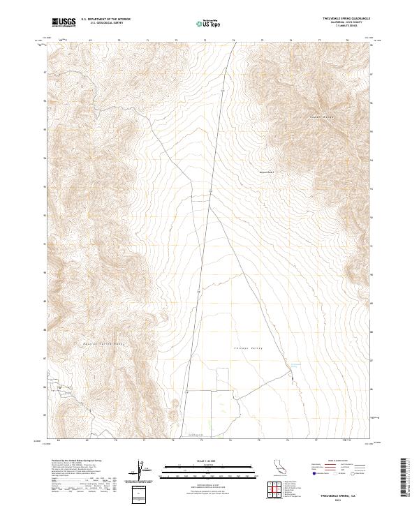
2021 Map of Twelvemile Spring
USGS Topo · Published 2021About this map
Twelvemile Spring provides a critical water source in the arid expanse of the Chicago Valley, situated between two prominent mountain chains. This 2021 survey by the U.S. Geological Survey illustrates the stark topography of the eastern Mojave Desert, where the Nopah Range dominates the eastern horizon and the Resting Spring Range rises to the west. The landscape is defined by its isolation and the simple infrastructure of Chicago Valley Rd, which traverses the basin floor. Such maps are essential for understanding the hydrology of the Great Basin, where isolated springs like this one historically dictated travel routes and settlement patterns in an otherwise unforgiving desert environment.
Find a feature on this map
10 named features on this map. Tap any name to fly to it.
Don’t see what you’re looking for? This feature index may not catch every label — zoom into the map to look around manually.
Map Details
Editions of this 2021 Twelvemile Spring Map
This is the sole edition of this map. No revisions or reprints were ever made.
Other maps of this area

1908 · Furnace Creek
USGS Topo · 1:250,000

1910 · Furnace Creek
USGS Topo · 1:250,000

1933 · Avawatz Mountains
USGS Topo · 1:250,000

1940 · Eagle Tank
USGS Topo · 1:62,500

1947 · Trona
USGS Topo · 1:250,000

1948 · Trona
USGS Topo · 1:250,000

1948 · Death Valley
USGS Topo · 1:250,000

1950 · Tecopa
USGS Topo · 1:62,500

1951 · Tecopa
USGS Topo · 1:62,500

1951 · Eagle Mtn
USGS Topo · 1:62,500