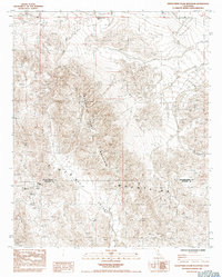
1985 Map of Twentynine Palms Mountain
USGS Topo · Published 1993About this map
Gold Park sits at the southern edge of this Mojave Desert landscape, serving as a focal point for historic mining activity along the San Bernardino and Riverside County line. The desert floor gives way to the prominent Twentynine Palms Mountain and the expansive ridges of the Pinto Mountains, where numerous small-scale mining operations once sought fortune. Significant workings such as the North Star Mine, Atlanta Mine, and the Goat Basin Mine are clearly marked, illustrating the localized density of prospecting in this arid environment. The terrain is defined by dry washes and the broad sweep of Music Valley, showing a region largely undeveloped save for its mineral interests and the specialized Rifle & Pistol Ranges located to the north near a local Quarry.
Find a feature on this map
13 named features on this map. Tap any name to fly to it.
Don’t see what you’re looking for? This feature index may not catch every label — zoom into the map to look around manually.
Map Details
Editions of this 1985 Twentynine Palms Mountain Map
2 editions found
Other maps of this area

1942 · Amboy
USGS Topo · 1:250,000

1943 · Amboy
USGS Topo · 1:250,000

1943 · Pinkham Well
USGS Topo · 1:62,500

1944 · Pinkham Well
USGS Topo · 1:62,500

1944 · Pinyon Well
USGS Topo · 1:62,500

1947 · Santa Ana
USGS Topo · 1:250,000

1949 · Santa Ana
USGS Topo · 1:250,000

1953 · San Bernardino
USGS Topo · 1:250,000

1954 · Salton Sea
USGS Topo · 1:250,000

1954 · Needles
USGS Topo · 1:250,000