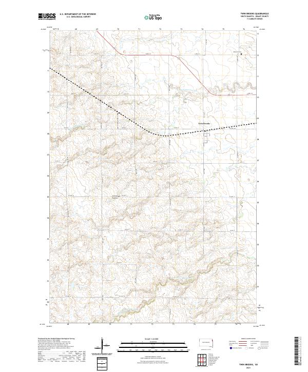
2021 Map of Twin Brooks
USGS Topo · Published 2021About this map
Twin Brooks serves as the central hub of this eastern South Dakota landscape, where the agricultural grid meets the distinct elevation changes of the Coteau des Prairies. The survey reveals a region defined by its drainage patterns, with the S Fork Whetstone River winding through the northern sections and the N Fork Yellow Bank River crossing the southern reaches. The geometric precision of section lines, including 471st Ave and Co Hwy 14, contrasts with the natural contours of the plateau. Notable local landmarks like Kilborn 2 Gem provide specific points of interest for those tracing property records or local heritage. The layout of the small settlement at Twin Brooks is clearly visible along Railway Ave, illustrating the historical relationship between prairie towns and the rail lines that facilitated their growth.
Find a feature on this map
26 named features on this map. Tap any name to fly to it.
Don’t see what you’re looking for? This feature index may not catch every label — zoom into the map to look around manually.
Map Details
Editions of this 2021 Twin Brooks Map
This is the sole edition of this map. No revisions or reprints were ever made.
Other maps of this area

1953 · Milbank
USGS Topo · 1:250,000

1954 · Big Stone Lake
USGS Topo · 1:62,500

1958 · Milbank
USGS Topo · 1:250,000

1970 · Marvin
USGS Topo · 1:24,000

1971 · Corona
USGS Topo · 1:24,000

1971 · Big Stone Lake SW
USGS Topo · 1:24,000

1973 · Twin Brooks
USGS Topo · 1:24,000

1973 · LaBolt
USGS Topo · 1:24,000
1973 · Milbank West
USGS Topo · 1:24,000

1973 · Stockholm
USGS Topo · 1:24,000