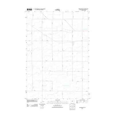
2012 Map of Twin Brooks
USGS Topo · Published 2012About this map
The S Fork Whetstone River meanders across the northern half of this Grant County landscape, defining the local drainage patterns near the turn of the 21st century. This region of South Dakota is characterized by a strict section-line road grid, which structures the agricultural movement across the terrain. Principal corridors like Co Hwy-8 and 471st Ave provide the primary north-south transit, while the southern reaches of the map are influenced by the N Fork Yellow Bank River. This survey captures the rural infrastructure as it stood in the early 2010s, highlighting the intersections of named township roads such as 148th St and 150th St that connect the dispersed farmsteads and fields of the Great Plains.
Find a feature on this map
17 named features on this map. Tap any name to fly to it.
Don’t see what you’re looking for? This feature index may not catch every label — zoom into the map to look around manually.
Map Details
Editions of this 2012 Twin Brooks Map
This is the sole edition of this map. No revisions or reprints were ever made.
Other maps of this area

1953 · Milbank
USGS Topo · 1:250,000

1954 · Big Stone Lake
USGS Topo · 1:62,500

1958 · Milbank
USGS Topo · 1:250,000

1970 · Marvin
USGS Topo · 1:24,000

1971 · Corona
USGS Topo · 1:24,000

1971 · Big Stone Lake SW
USGS Topo · 1:24,000

1973 · Twin Brooks
USGS Topo · 1:24,000

1973 · LaBolt
USGS Topo · 1:24,000
1973 · Milbank West
USGS Topo · 1:24,000

1973 · Stockholm
USGS Topo · 1:24,000