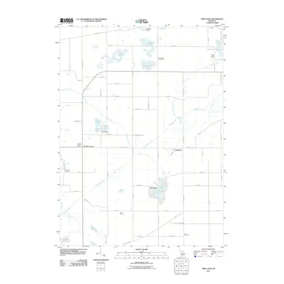
2011 Map of Twin Lakes
USGS Topo · Published 2011About this map
The Dowagiac River cuts a diagonal path through this section of Wayne Township, anchoring a landscape defined by glacial lakes and small rural settlements. The community of Twin Lakes sits at the center of the sheet, surrounded by water bodies including Knickerbocker Lake, School Lake, and Pine Lake. Further north, the settlement of Glenwood is positioned near the Dowagiac Drain, while Five Mile Corners serves as a western waypoint. Genealogists will find several local burial grounds documented here, including Hamilton Cemetery, North Wayne Cemetery, and the White Cemetery near Marcellus Hwy. Modern cultural landmarks such as the Five Mile Drive In Theater and recreation areas like Oak Shores Campground illustrate the area's transition toward a leisure and residential character in the early 21st century.
Find a feature on this map
67 named features on this map. Tap any name to fly to it.
Don’t see what you’re looking for? This feature index may not catch every label — zoom into the map to look around manually.
Map Details
Editions of this 2011 Twin Lakes Map
This is the sole edition of this map. No revisions or reprints were ever made.
Other maps of this area

1927 · Hartford
USGS Topo · 1:62,500

1931 · Hartford
USGS Topo · 1:62,500

1944 · Marcellus
USGS Topo · 1:62,500

1945 · Cassopolis
USGS Topo · 1:62,500

1946 · Marcellus
USGS Topo · 1:62,500

1947 · Cassopolis
USGS Topo · 1:62,500

1948 · Vandalia
USGS Topo · 1:62,500

1949 · Vandalia
USGS Topo · 1:62,500

1953 · Fort Wayne
USGS Topo · 1:250,000

1953 · Chicago
USGS Topo · 1:250,000